
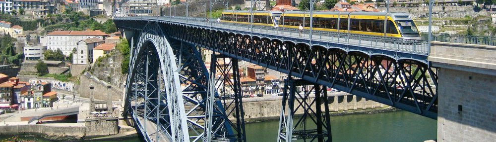
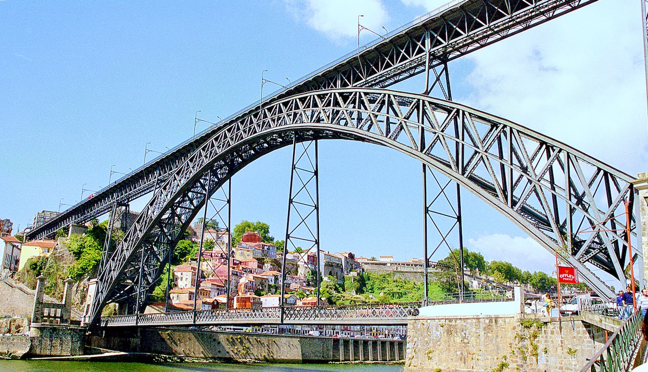
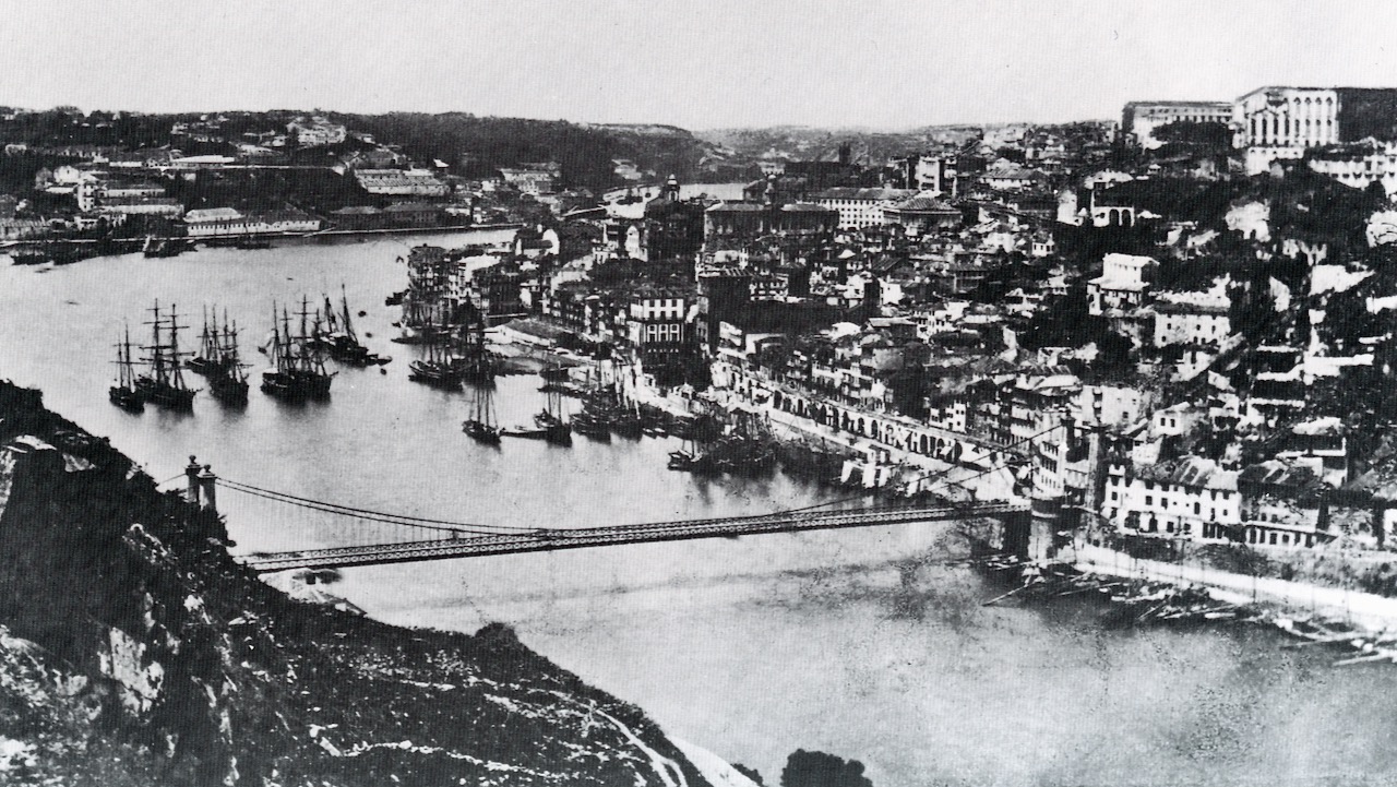
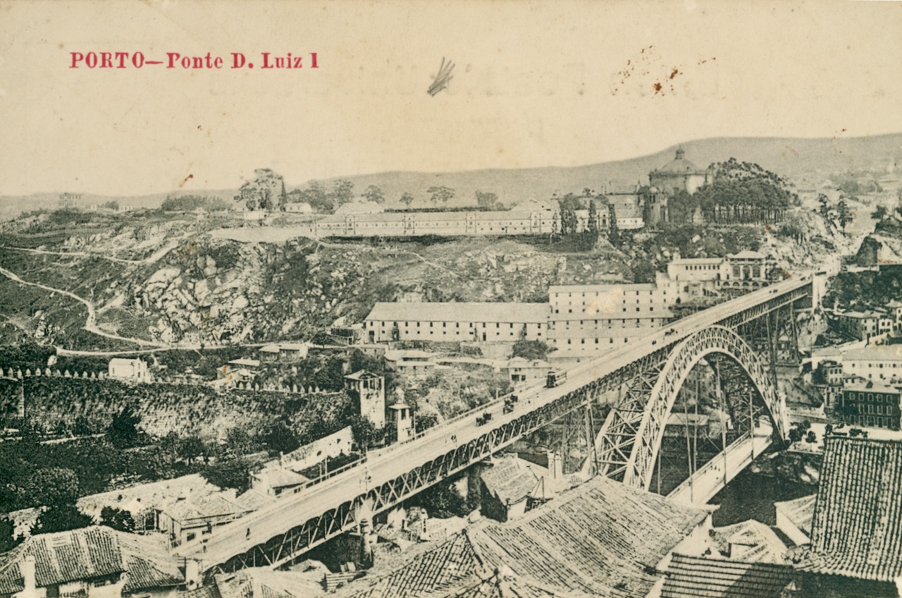
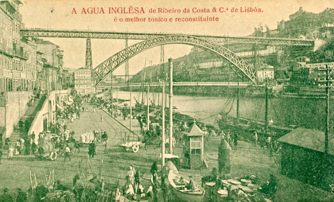
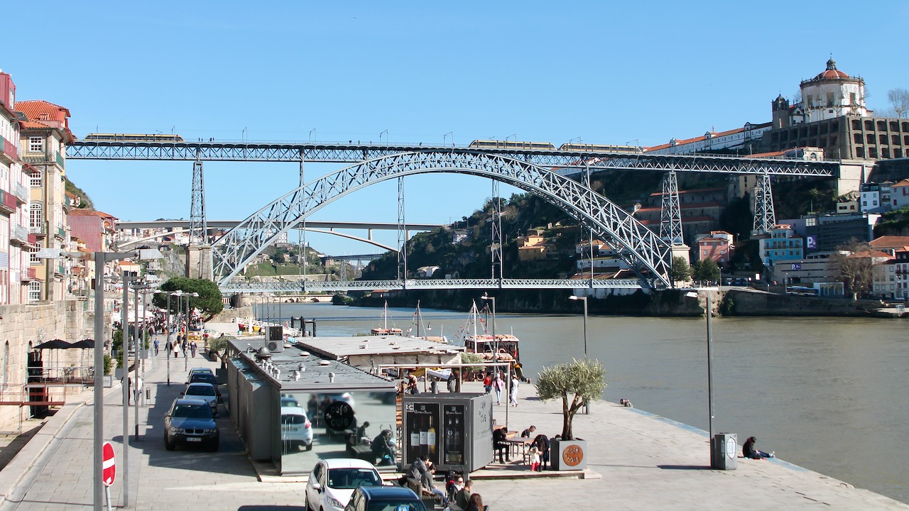
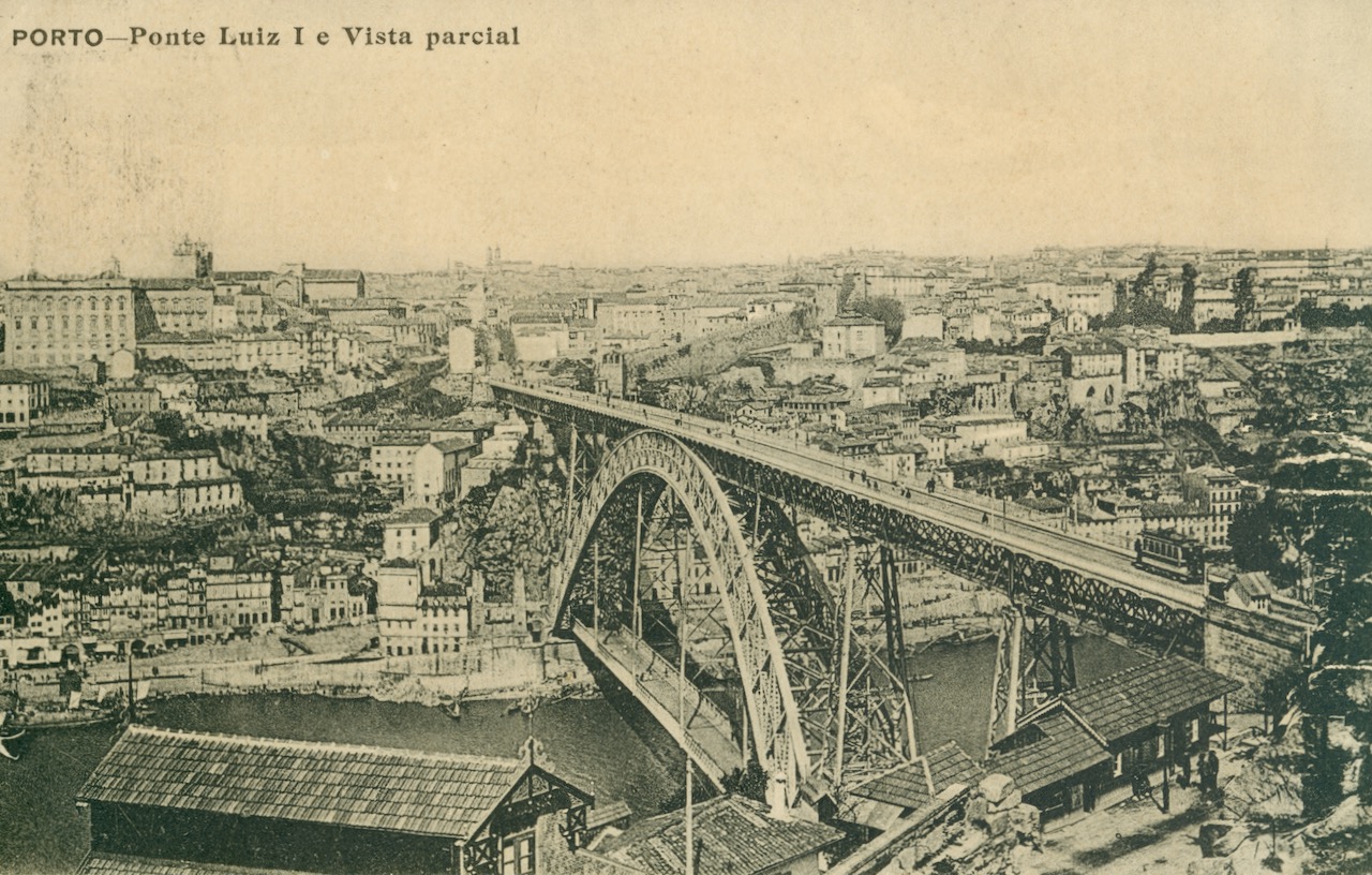
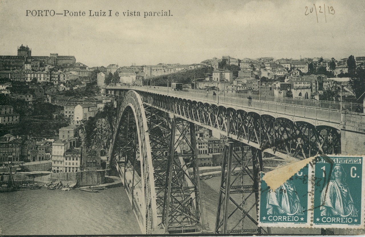
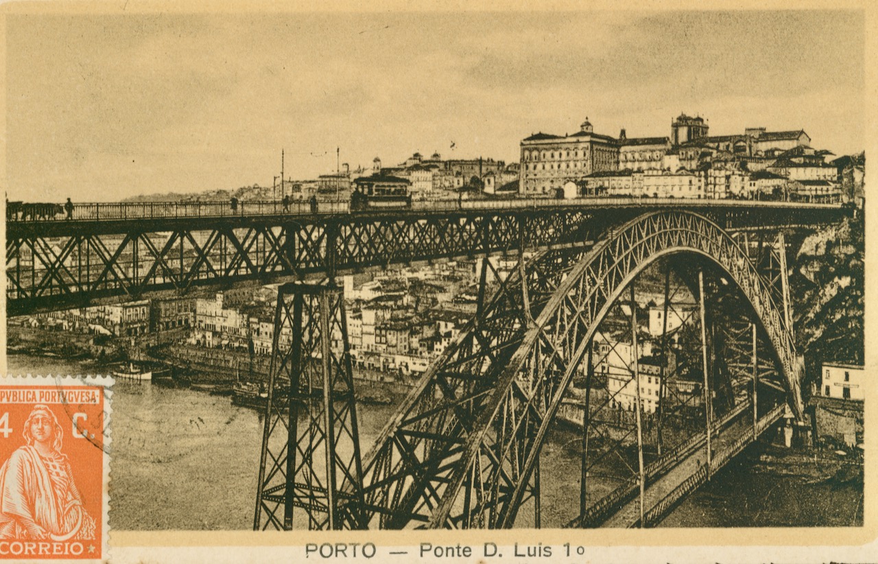
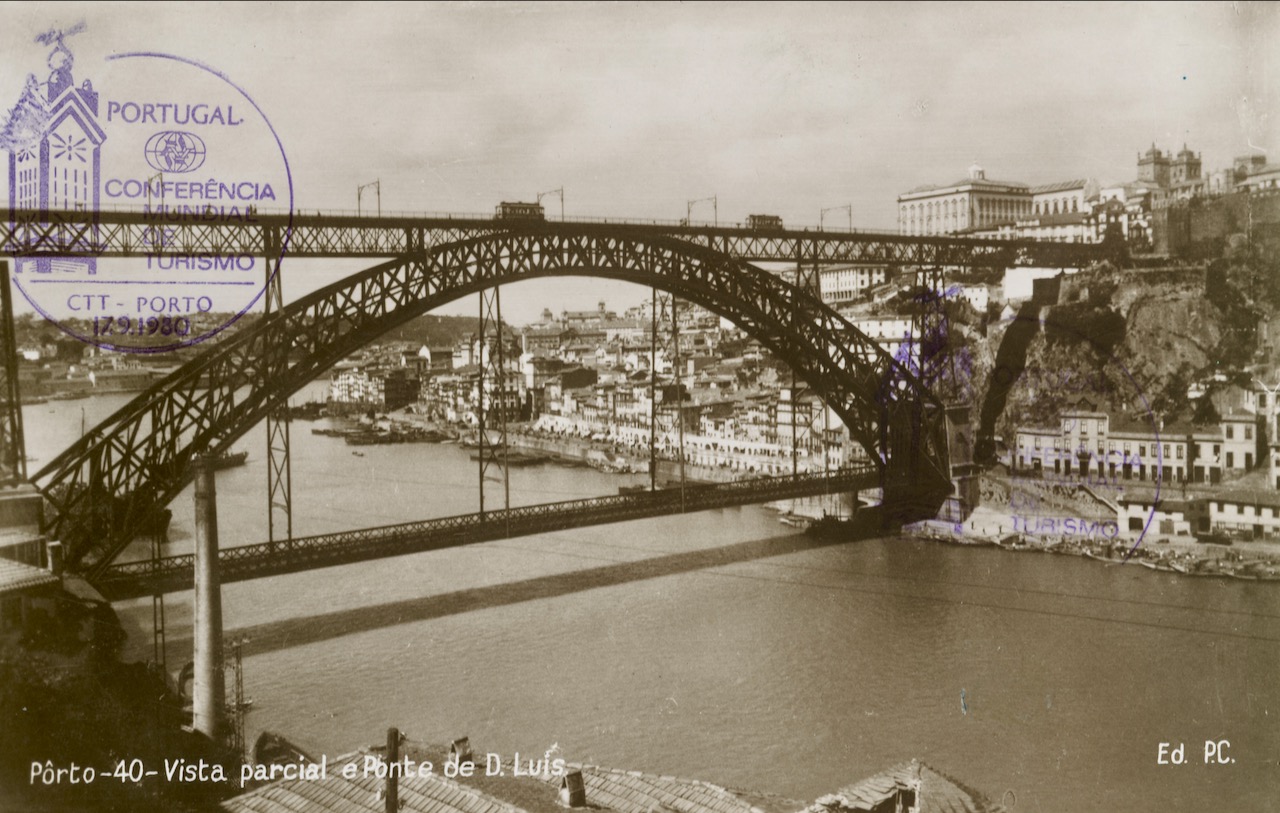
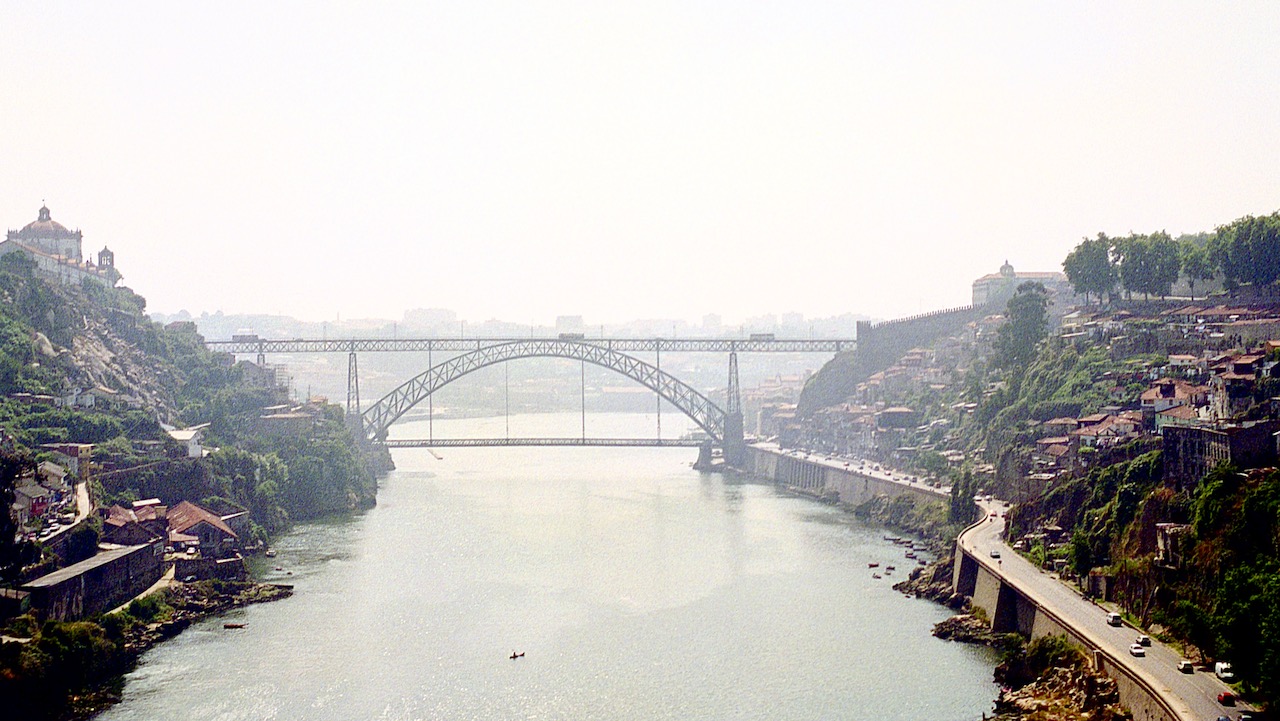
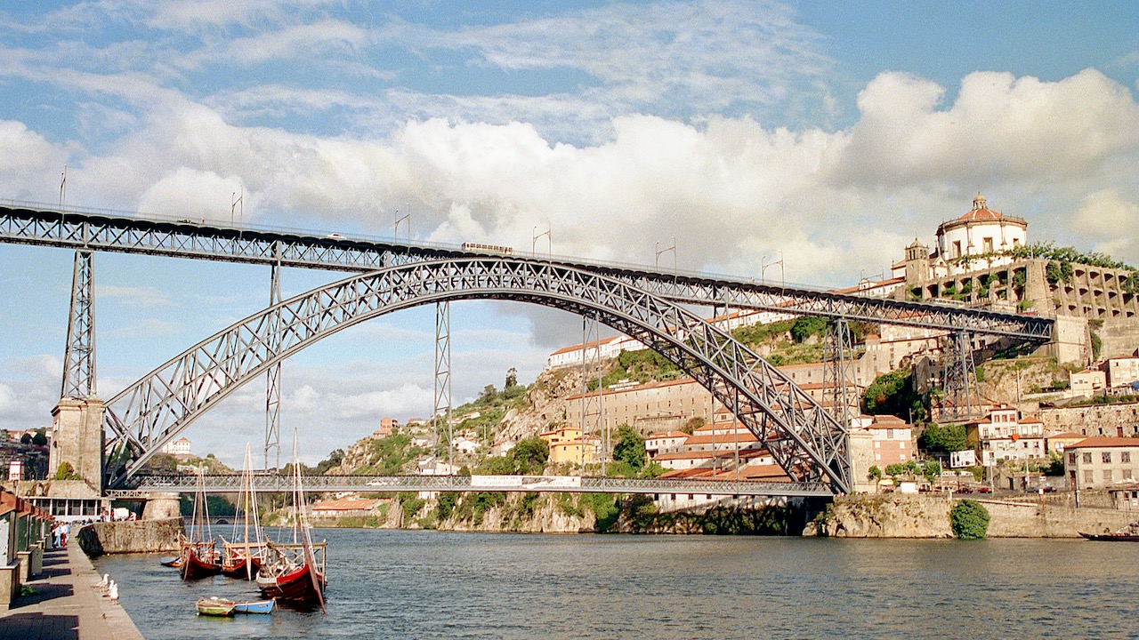
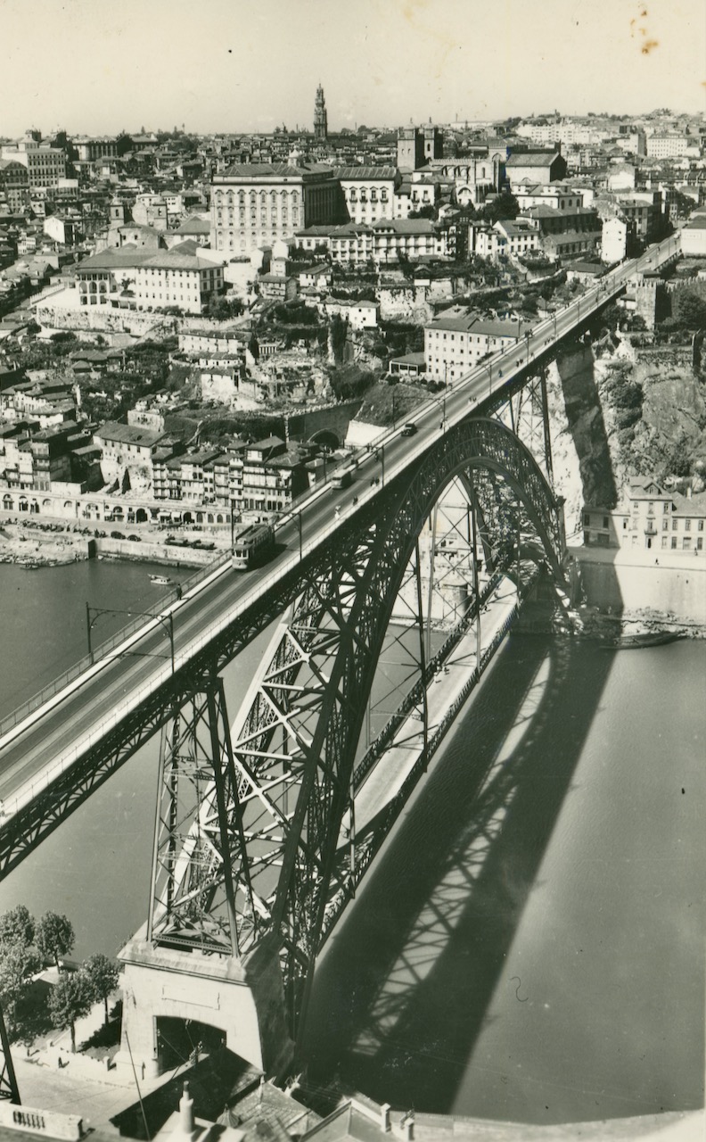
The Ponte Luís I, often called the Ponte Dom Luís, connects the central parts of Porto and VN de Gaia. It had and has a major role in the public transport of Porto and is one of the most important landmarks of the city. This bridge with two decks was built in the 1880’s as successor of the from 1843 dating Ponte Pênsil.
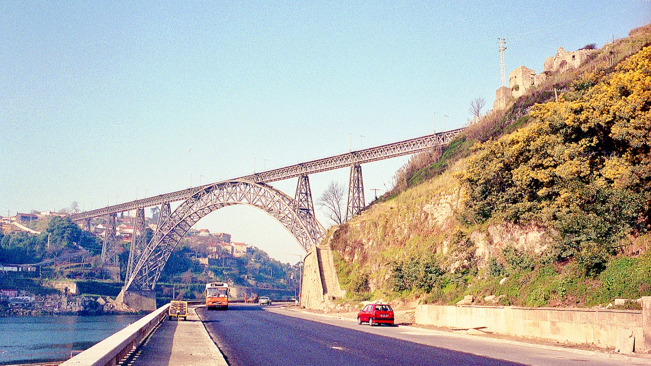
The design of the Ponte Luís I was by Téofile Seyrig, who with Gustave Eiffel had founded in 1869 the Eiffel & Cie Company. When still in partnership with Eiffel, Seyrig had designed the Ponte Dona Maria Pia railway bridge a few kilometres upstream across the Douro, which was built in 1876-1877 by Eiffel & Cie.
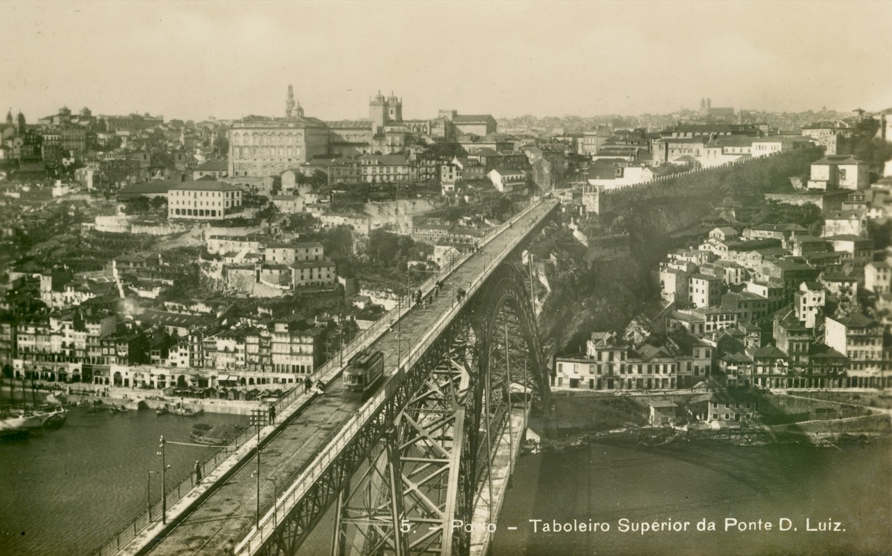
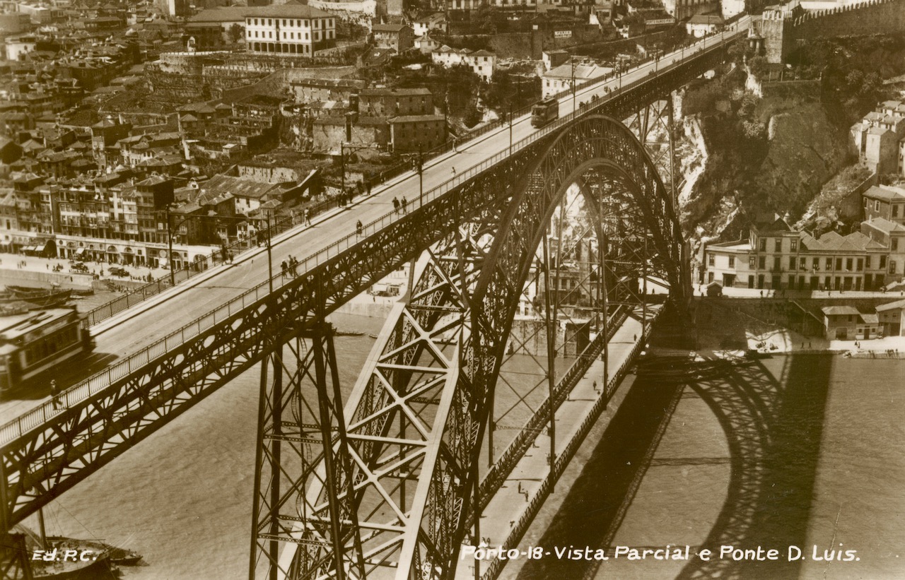
After a dispute Seyrig left Eiffel & Cie in 1879 and joined the Willebroeck company. For building the Ponte Luís I the design of Seyrig (Willebroeck) was preferred above those of Eiffel and several other competitors. The upper deck of the Ponte Luís I was opened in 1886, the lower deck in 1888.
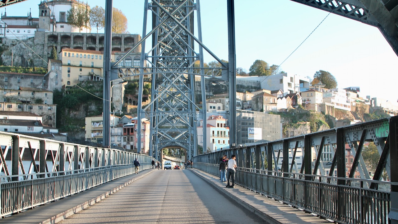
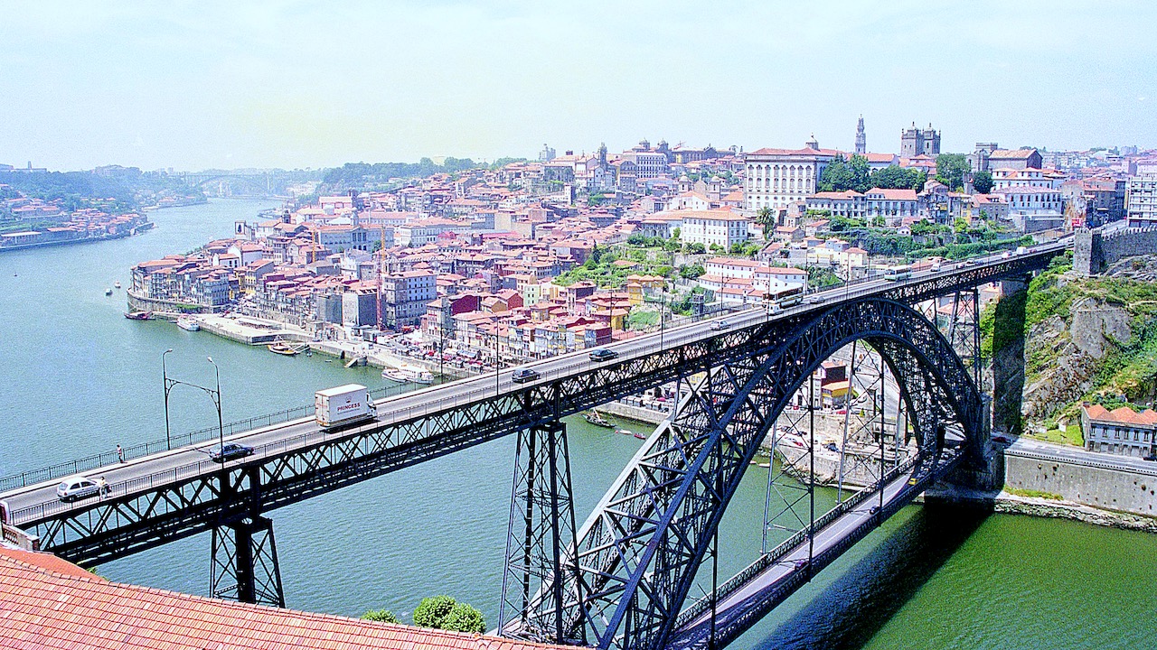
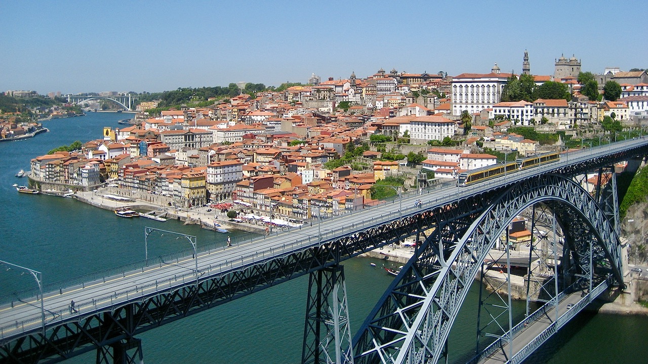
The total length of the upper deck is about 385 m, the lower deck about 145 m and the level difference between both decks about 45 m.
Unused horse / mule tram tracks
With the construction of the Ponte Luís I, tram tracks were laid on the upper deck of the bridge. These tracks were, like the bridge itself, owned by the Ministerio das Obras Publicas. The idea was that tram companies could use these tracks with horse or mule trams with paying a fee. The gauge of these tracks was 900 mm. Although concessions for tramlines across the bridge were granted, these came never into existence. In 1903 the old but never used tracks were removed from the bridge because they couldn’t be used for the projected electric tramlines to VN de Gaia.
Electric trams
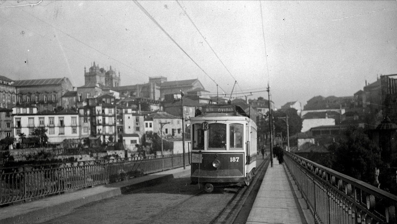
The electric tramlines to Gaia using the upper deck of the bridge were opened on 28 October 1905. One line went to Sto. Ovídio while the other went to Devesas.
On the bridge two trolley poles had to be used to prevent corrosion of the iron by stray electric currents. A number of tramcars were equipped with a second trolley pole for use on the lines to Gaia. In fact the fear for corrosion was overdone. There was no risk as long as the bridge was sufficiently earthed, but this wasn’t yet established knowledge around 1900. From 1933 the trams could run across the bridge with one trolley-pole.
In 1930 the single track on the bridge (situated at the eastern side) was changed to double track. The centres of the tracks were just 2.43 m apart, which meant that only narrow cars could be used.
There was also a tramline projected with the route Infante – Rua de São João – Praça da Ribeira – Ribeira – lower deck of the Ponte Dom Luis I – VN de Gaia. Although tracks were installed in 1912 between Infante and the bridge, this line was never opened. The tracks were removed a few years later again.
Access routes
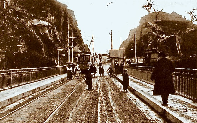
When the Ponte Luís I was built there were not yet straight wide roads to the upper deck. At the side of VN de Gaia was the hill of Serra do Pilar obstructing the shortest route for several more decades. Also the trams had to make a detour around the west side of the hill. After huge works to excavate the western part of the hill, the direct road could be made and the tramlines got a shorter straight route.
At the Porto side was a dense built-up area of very old houses with only the route via Rua Loureiro and Rua Chã wide enough for trams, but still that narrow that only single track could be installed. A second but longer route existed via Praça da Batalha, which became the main route of the Gaia tramlines. The route via Rua Loureiro and Rua Chã was soon abandoned. A wide road between Praça Almeida Garrett and the bridge was already planned during the first decade of the 20th century, but could only be constructed after the demolition of the houses in the area during the late 1940’s. By that time the plans for replacing the trams by trolleybuses were already under development and the trams never used the new road.
The access to the lower deck at the Porto side was via the busy quay of Ribeira. Only in 1956 the Túnel da Ribeira was inaugurated and through traffic didn’t have to use the old route anymore. At the Gaia side the access was always, and still is via the road at the river side.
Trolleybuses, Diesel buses and Eurotrams
In 1959 the tramlines across the bridge were replaced by trolleybuses. In contrast to the trams the trolleybuses also used the lower deck. In 1993 all trolleybus services across the bridge were replaced by Diesel buses.
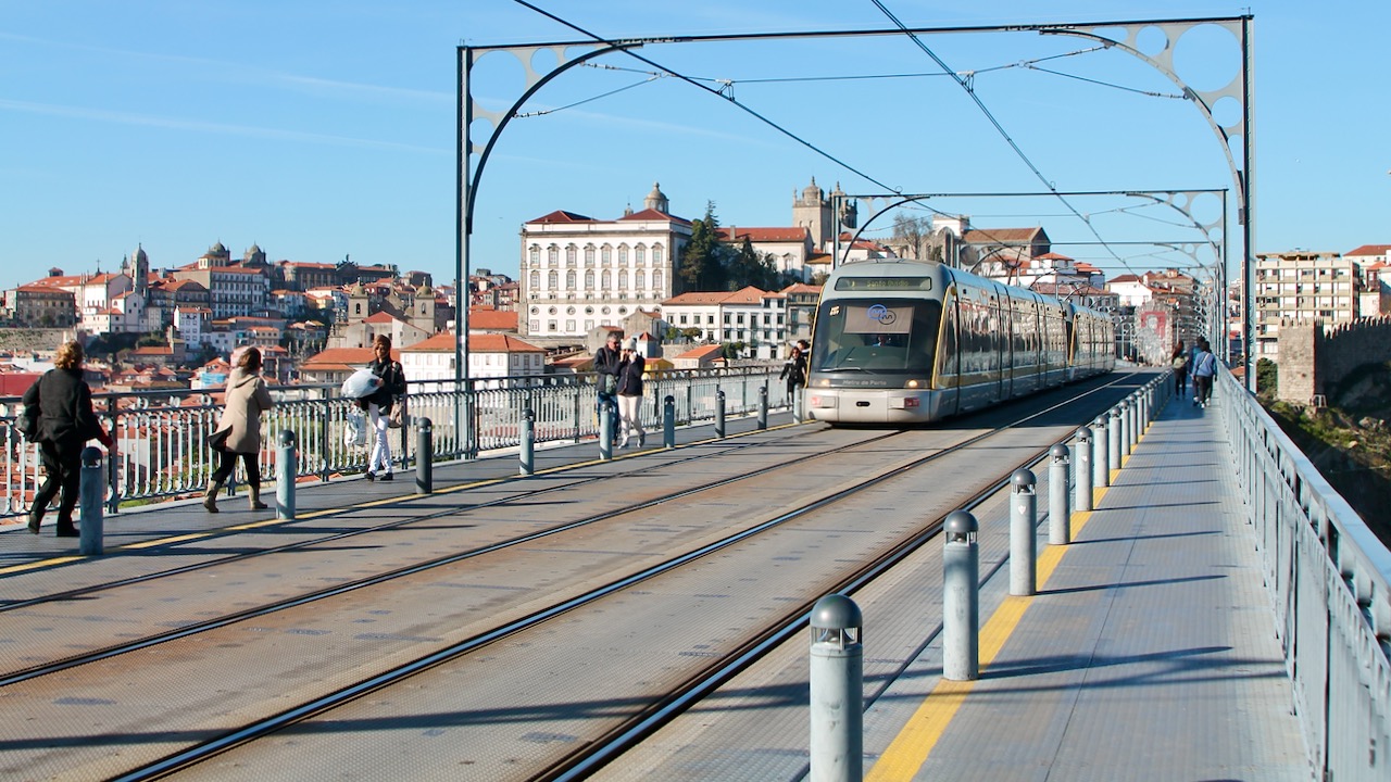
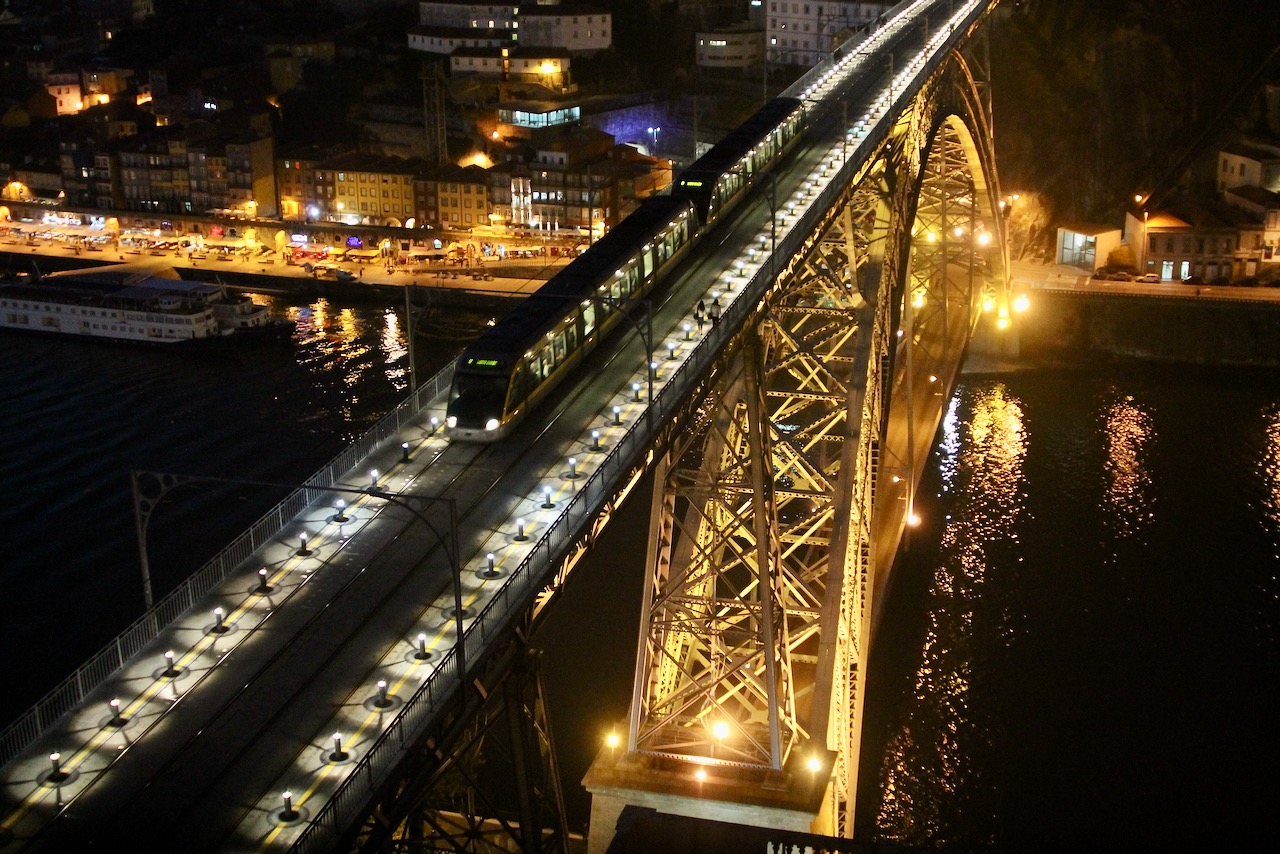
In 2003 following the opening of the adjacent Ponte Infante Dom Henrique all traffic across the upper deck was suspended to enable the renovation of the bridge and make it suitable for use by line D of the Metro do Porto. This line was opened on 17 September 2005. The upper deck of the bridge was made wider to accommodate the Eurotrams and is now reserved to the Metro do Porto and pedestrians. The lower deck is still used by road traffic.
For 77 years the Ponte Luís I was the only road bridge across the Douro between Porto and VN de Gaia. It couldn’t cope with the increasing traffic and new bridges were constructed. First in 1963 the Ponte d’Arrábida several kilometers to the west. In 1995 followed the Ponte do Freixo several kilometers to the east. In 2003 the Ponte Infante Dom Henrique was opened, several hundreds of meters east of the Ponte Luís I and meant as replacement for the upper deck of the latter.
Gallery
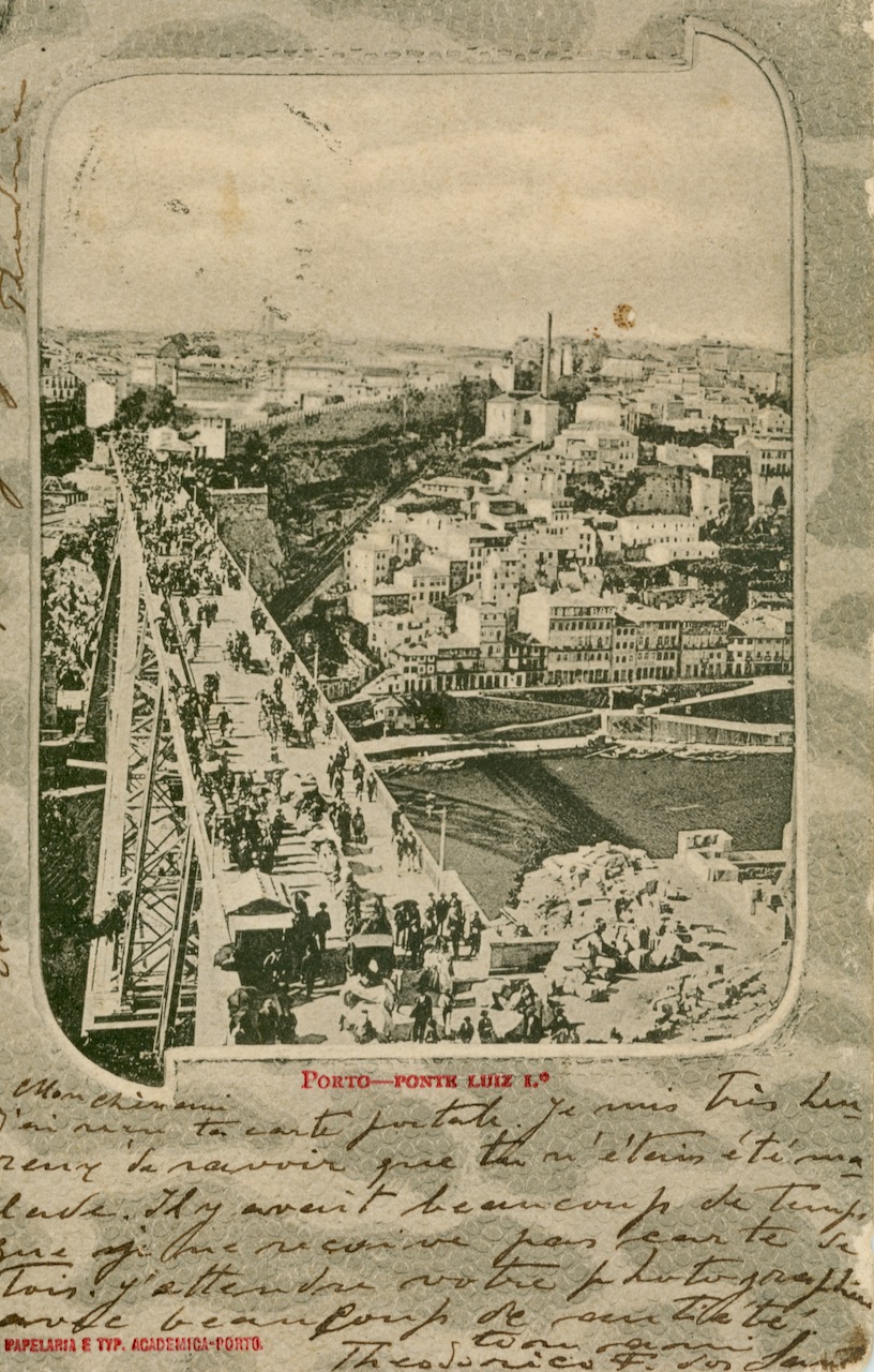
Over the time the Ponte Luís I was always a popular subject for photos and postcards.

Leave a Reply